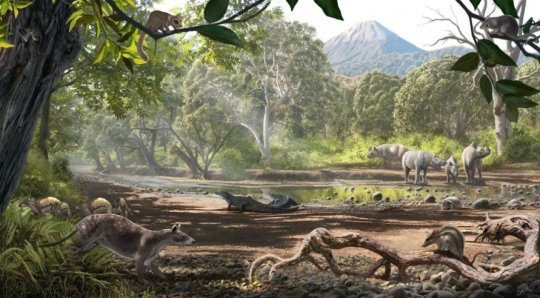
The first appearance of trilobites in the fossil record dates to 521 million years ago in the oceans of the Cambrian Period, when the continents were still inhospitable to most life forms. Few groups of animals adapted as successfully as trilobites, which were arthropods that lived on the seabed for 270 million years until the mass extinction at the end of the Permian approximately 252 million years ago.
The longer ago organisms lived, the more rare are their fossils and the harder it is to understand their way of life; paleontologists face a daunting task in endeavoring to establish evolutionary relationships in time and space.
Surmounting the difficulties inherent in the investigation of a group of animals that lived such a long time ago, Brazilian scientists affiliated with the Biology Department of São Paulo State University’s Bauru School of Sciences (FC-UNESP) and the Paleontology Laboratory of the University of São Paulo’s Ribeirão Preto School of Philosophy, Science and Letters (FFCLRP-USP) have succeeded for the first time in inferring paleobiogeographic patterns among trilobites.
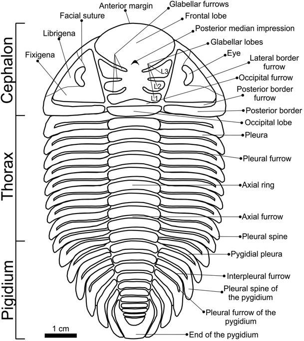
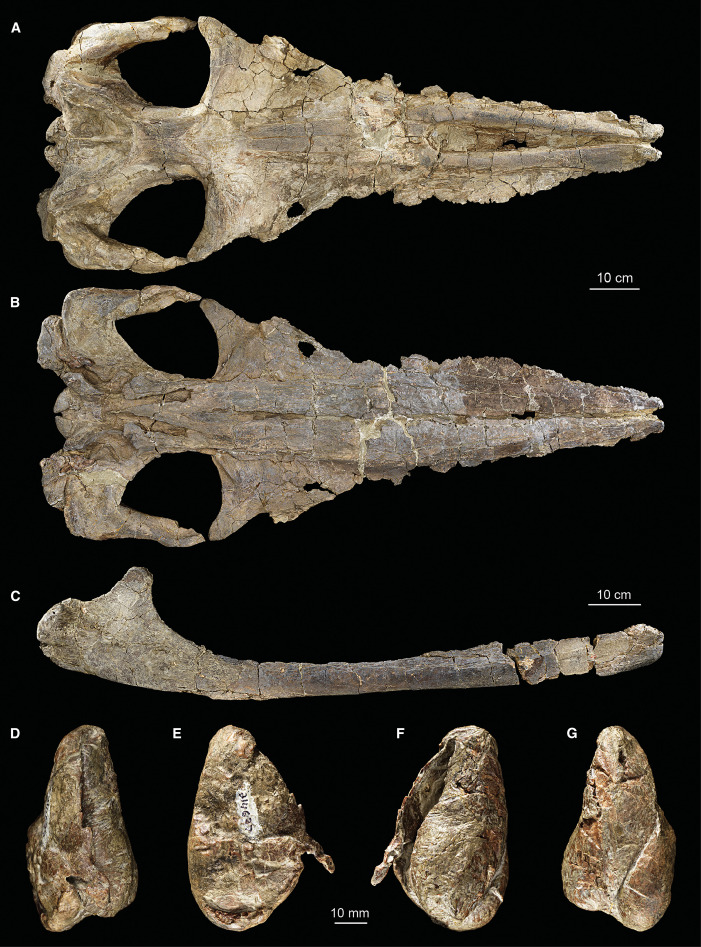
Schematic drawing showing the major exoskeleton elements of the dorsal surface of Metacryphaeus.
Paleobiogeography is a branch of paleontology that focuses on the distribution of extinct plants and animals and their relations with ancient geographic features. The study was conducted by Fábio Augusto Carbonaro, a postdoctoral researcher at UNESP’s Bauru Macroinvertebrate Paleontology Laboratory (LAPALMA) headed by Professor Renato Pirani Ghilardi. Other participants included Max Cardoso Langer, a professor at FFCLRP-USP, and Silvio Shigueo Nihei, a professor at the same university’s Bioscience Institute (IB-USP).
The researchers analyzed the morphological differences and similarities of the 11 species of trilobites described so far in the genus Metacryphaeus; these trilobites lived during the Devonian between 416 million and 359 million years ago (mya) in the cold waters of the sea that covered what is now Bolivia, Peru, Brazil, the Malvinas (Falklands) and South Africa.
The Devonian Period is subdivided into seven stages. Metacryphaeus lived during the Lochkovian (419.2-410.8 mya) and Pragian (410.8- 407.6 mya) stages, which are the earliest Devonian stages.
The results of the research were published in Scientific Reportsand are part of the project “Paleobiogeography and migratory routes of paleoinvertebrates of the Devonian in Brazil,” which is supported by São Paulo Research Foundation -FAPESP and Brazil’s National Council for Scientific and Technological Development (CNPq). Ghilardi is the project’s principal investigator.
“When they became extinct in the Permian, 252 million years ago, the trilobites left no descendants. Their closest living relatives are shrimps, and, more remotely, spiders, scorpions, sea spiders and mites,” Ghilardi said.
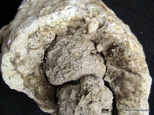
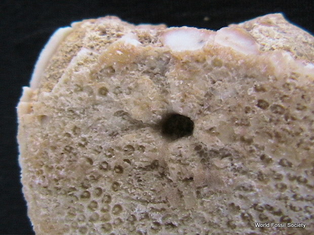
Trilobite fossils are found abundantly all over the world, he explained — so abundantly that they are sometimes referred to as the cockroaches of the sea. The comparison is not unwarranted because anatomically, the trilobites resemble cockroaches. The difference is that they were not insects and had three longitudinal body segments or lobes (hence the name).
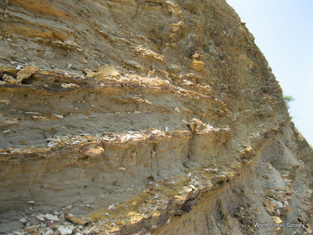
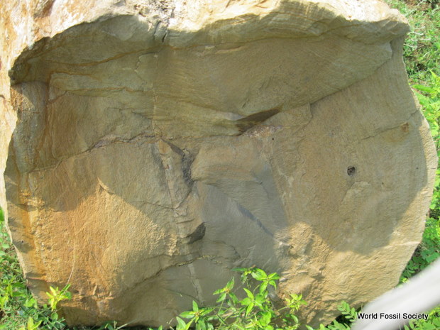
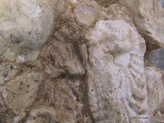
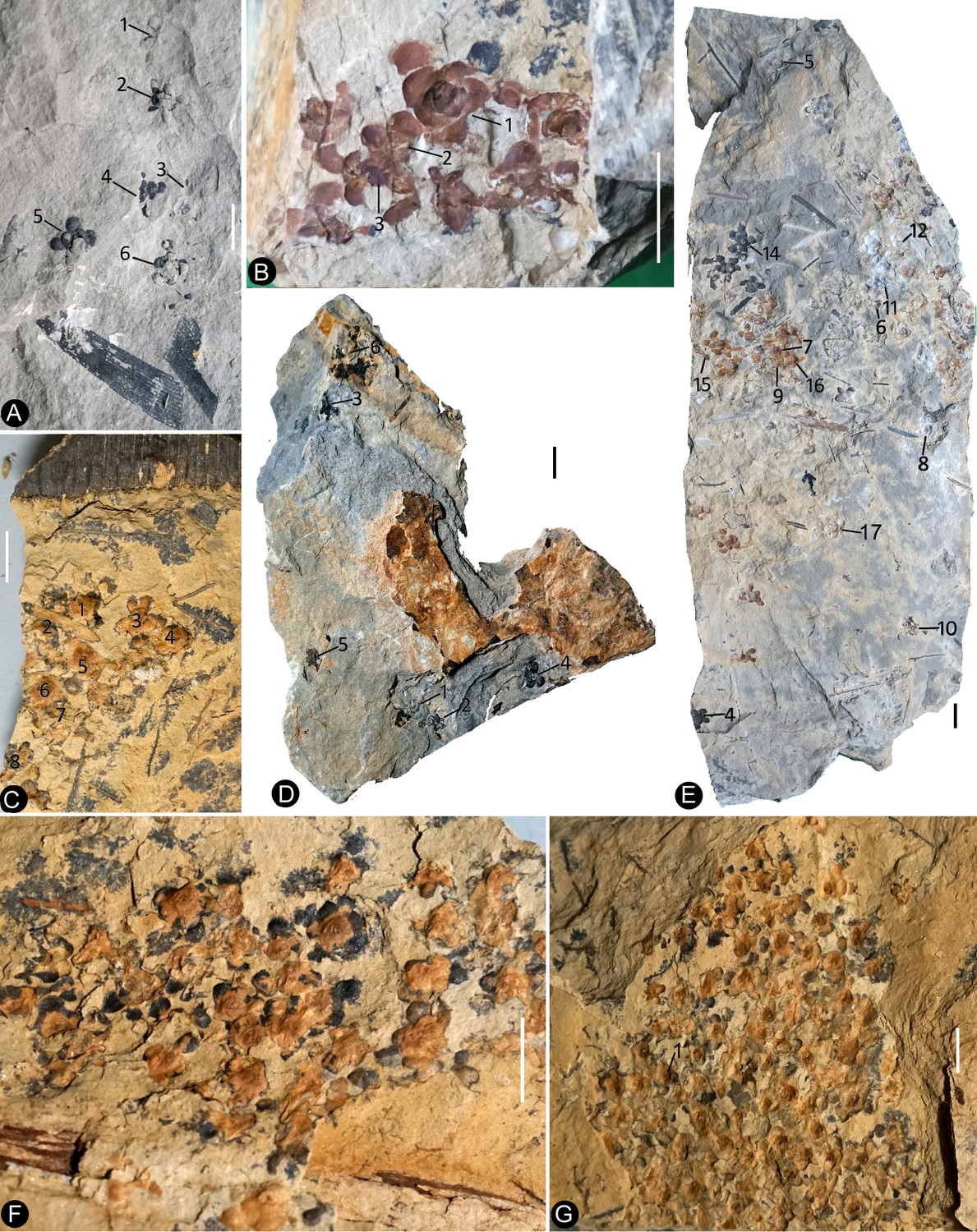
In the northern hemisphere, the trilobite fossil record is very rich. Paleontologists have so far described ten orders comprising over 17,000 species. The smallest were 1.5 millimeters long, while the largest were approximately 70 cm long and 40 cm wide. Perfectly preserved trilobites can be found in some regions, such as Morocco. These can be beautiful when used to create cameos or intaglio jewelry. Trilobite fossils from Brazil, Peru and Bolivia, in contrast, are often poorly preserved, consisting merely of the impressions left in benthic mud by their exoskeletons.
“Although their state of preservation is far from ideal, there are thousands of trilobite fossils in the sediments that form the Paraná basin in the South region of Brazil, and the Parnaíba basin along the North-Northeast divide,” said Ghilardi, who also chairs the Brazilian Paleontology Society.
According to Ghilardi, their poor state of preservation could be due to the geological conditions and climate prevailing in these regions during the Paleozoic Era, when the portions of dry land that would one day form South America were at the South Pole and entirely covered by ice for prolonged periods.
During the Devonian, South America and Africa were connected as part of the supercontinent Gondwana. South Africa was joined with Uruguay and Argentina in the River Plate region, and Brazil’s southern states were continuous with Namibia and Angola.
Parsimonious analysis
The research began with an analysis of 48 characteristics (size, shape and structure of organs and anatomical parts) found in some 50 fossil specimens of the 11 species of Metacryphaeus.
“In principle, these characteristics serve to establish their phylogeny — the evolutionary history of all species in the universe, analyzed in terms of lines of descent and relationships among broader groups,” Ghilardi said.
Known as a parsimonious analysis, this method is widely used to establish relationships among organisms in a given ecosystem, and in recent years, it has also begun to be used in the study of fossils.
According to Ghilardi, parsimony, in general, is the principle that the simplest explanation of the data is the preferred explanation. In the analysis of phylogeny, it means that the hypothesis regarding relationships that requires the smallest number of characteristic changes between the species analyzed (in this case, trilobites of the genus Metacryphaeus) is the one that is most likely to be correct.
The biogeographic contribution to the study was made by Professor Nihei, who works at IB-USP as a taxonomist and insect systematist. The field of systematics is concerned with evolutionary changes between ancestries, while taxonomy focuses on classifying and naming organisms.
“Biogeographic analysis typically involves living groups the ages of which are estimated by molecular phylogeny, or the so-called molecular clock, which estimates when two species probably diverged on the basis of the number of molecular differences in their DNA. In this study of trilobites, we used age in a similar manner, but it was obtained from the fossil record,” Nihei said.
“The main point of the study was to use fossils in a method that normally involves molecular biogeography. Very few studies of this type have previously involved fossils. I believe our study paves the way for a new approach based on biogeographic methods requiring a chronogram [a molecularly dated cladogram] because this chronogram can also be obtained from fossil taxa such as those studied by paleontologists, rather than molecular cladograms for living animals.”
As a vertebrate paleontologist who specializes in dinosaurs, Langer acknowledged that he knows little about trilobites but a great deal about the modern computational techniques used in parsimonious analysis, on which his participation in the study was based. “I believe the key aspect of this study, and the reason it was accepted for publication in as important a journal as Scientific Reports, is that it’s the first ever use of parsimony to understand the phylogeny of a trilobite genus in the southern hemisphere,” he said.
Gondwanan dispersal
The results of the paleobiogeographical analyses reinforce the pre-existing theory that Bolivia and Peru formed the ancestral home of Metacryphaeus.
“The models estimate a 100% probability that Bolivia and Peru formed the ancestral area of the Metacryphaeus clade and most of its internal clades,” Ghilardi said. Confirmation of the theory shows that parsimonious models have the power to suggest the presence of clades at a specific moment in the past even when there are no known physical records of that presence.
In the case of Metacryphaeus, the oldest records in Bolivia and Peru date from the early Pragian stage (410.8-407.6 mya), but the genus is believed to have evolved in the region during the Lochkovian stage (419.2-410.8 mya).
Parsimony, therefore, suggests Metacryphaeus originated in Bolivia and Peru some time before 410.8 mya but not earlier than 419.2 mya. In any event, it is believed to be far older than any known fossils.
According to Ghilardi, the results can be interpreted as showing that the adaptive radiation of Metacryphaeus to other areas of western Gondwana occurred during episodes of marine transgression in the Lochkovian-Pragian, when the sea flooded parts of Gondwana.
“The dispersal of Metacryphaeus trilobites during the Lochkovian occurred from Bolivia and Peru to Brazil — to the Paraná basin, now in the South region, and the Parnaíba basin, on the North-Northeast divide — and on toward the Malvinas/Falklands, while the Pragian dispersal occurred toward South Africa,” he said.
Fossil trilobites have been found continuously in the Paraná basin in recent decades. Trilobites collected in the late nineteenth century in the Parnaíba basin were held by Brazil’s National Museum in Rio de Janeiro, which was destroyed by fire in September 2018.
“These fossils haven’t yet been found under the rubble and it’s likely that nothing is left of them. They were mere shell impressions left in the ancient seabed. Even in petrified form, they must have dissolved in the blaze,” Ghilardi said.


 January 18th, 2019
  Riffin
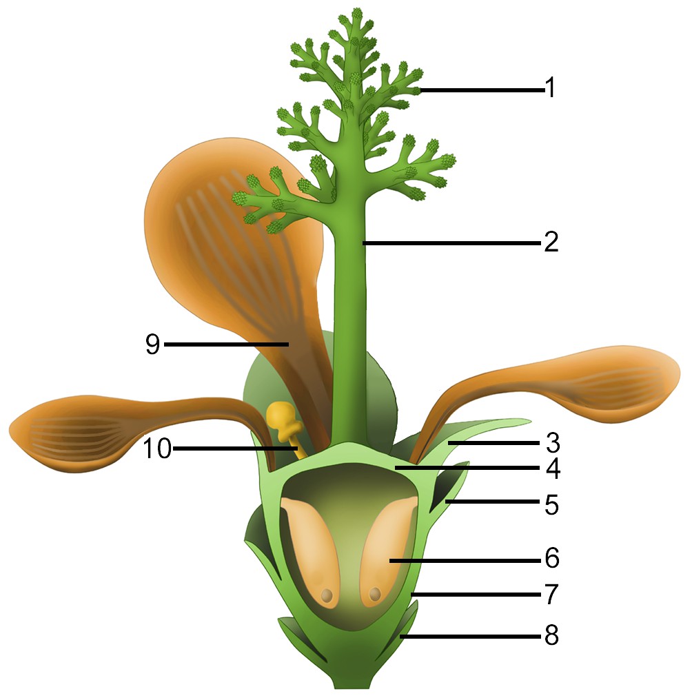
![Figure illustrates a composite phylogeny including results from this analysis (Figure S4) and recently published analyses [5, 7, 8]. (A) Time calibrated simplified phylogeny, with collapsed clade resolution for Mammalodontidae, Aetiocetidae and Eomysticetidae, and crown Mysticeti. (B–E) Colored bars indicate groups figured; gray bars indicate groups not figured. Panels (b–e) represent 3D models of select specimens in lateral view with artistic reconstructions of their feeding modes: (B) Basilosaurus isis; (C) Coronodon havensteini; (D) Maiabalaena nesbittae; and (E) Balaenoptera musculus. These panels illustrate the loss of a functional dentition, the intermediate phase with neither teeth nor baleen, and the subsequent origin of baleen. Illustrations are original artwork by Alex Boersma (www.alexboersma.com).](http://www.worldfossilsociety.org/wp-content/uploads/2018/12/thomashobbes1-1.jpg)